Everyone in the United States who flies drones for commercial purposes is required to hold a current Part 107 license from the FAA. Read on for Smart Construction's tips on what you will need to pass with flying colors.
Summary
New technologies are being introduced to the construction industry every day, it seems. However, it often takes quite a while for the industry to adopt new technologies as most companies do not have time to implement them or the news doesn’t spread fast enough.
Amongst the new technologies introduced to the market in recent years, drones are a solution familiar to most of the industry. Using drones can increase efficiency, reduce expenses, improve data accuracy, and create a digital twin to improve field and office communication and accurately track jobsite progress. We recently wrote about use cases for drones in construction, so this article will help you understand how to get started with drones. It will provide information on the types of drones on the market, drone licenses & registration requirements, pre-flight activities, how to fly the drone, and regulations.
Buying the Right Drone
There are many drones in the market these days that vary in size, shape, features, and specifications. It's important to find the right drone for your purpose to avoid unnecessary costs and headaches.
If you need a drone only to take aerial pictures of a jobsite or have visuals on hard-to-reach areas, a small, inexpensive camera drone could be enough. However, more advanced use cases like stockpile analysis require more advanced drones. Advanced drones can survey the site and map out the 3D design to plan the cuts and fills of a jobsite so you can be more accurate in estimating the material movements required.
When considering purchasing a drone, it might be difficult to decide as there are many types and models available today. Drones used in construction can be broken down to three major categories:
- Multi-rotor drones
- Fixed-wing drones
- VTOL drones
Typically, the type of jobsite, project, and your company's goals for flying drones will determine which drone is right for the job.
Multi-Rotor Drones
These drones are the most widely used drones on the market. They have four rotors on the top like a helicopter, allowing them to hover in one spot or operate within a limited space. These drones are excellent for small to mid-size earthwork or vertical construction, but they aren't ideal for large sites (over 500 acres) as these drones are relatively slow and have limited flight time, requiring numerous battery changes for a single map.
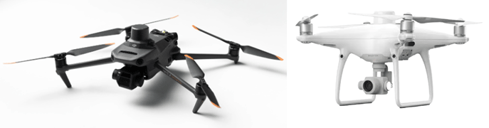
DJI's Mavic 3 Enterprise (left) and Phantom 4 RTK (right), two of the most popular, capable, and affordable multi-rotor drones on the market today. Source: dji.com
Fixed Wing Drones
If a multi-rotor drone is like a helicopter, a fixed-wing drone is like an airplane. These drones cannot take off vertically, hover, or maneuver like multi-rotor drones and they require more space to fly. However, they are faster with a longer flight time suitable for covering larger terrain. These would be ideal for a large-scale project, such as road construction. These drones also require a clear view of the sky as the drone should always be within the site of the drone pilot or the visual observer.
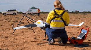
Source: auav.com
VTOL (Vertical Takeoff and Landing) Drones
These drones are a combination of both multi-rotorand fixed wing drones. They can lift vertically and have the speed and flight time of the fixed-wing drones while requiring less room to operate. They can both hover over the jobsite like a multirotor drone or fly fast over a larger area like the fixed-wing drones. The main disadvantage to these style drones is they tend to be expensive.
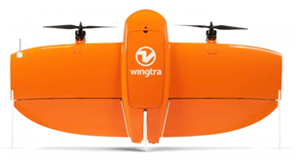
Source: wingtra.com
Recreational Drones
Recreational drones are smaller drones under 250g. These drones can be used to take pictures of hard-to-reach places or capture an image of the jobsite. Although you don't necessarily need a Part 107 license to operate these drones, using these drones for anything outside of personal use will require passing the Part107 exam.
Regardless of which drone you choose, it is important to know that your drone pilot needs to pass the FAA's Part 107 exam to use the drone on the job. Remember, even taking photos of a jobsite or a corporate group photo for the website are considered to be commercial use. Read our guide on passing the Part 107 exam to learn more.
Other Equipment for Drone Operations
To successfully use drones in your business, you may need additional equipment like ground control points, drone parachutes, and other accessories.
Ground control points (GCP) 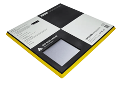 are used in projects that demand precision mapping. For drone surveying, investing in a smart GCP like Propeller's AeroPoint (pictured right) is recommended as it allows the drones to identify the actual GPS coordination of the unit. The GCPs are essential when mapping the terrain with true global accuracy to tag the drone image’s location.
Ideally, three or more smart GCP units are recommended to be used for a flight, depending on the size of the area you're mapping. These can also be used for the landing pad for the drone.
A drone parachute is a 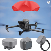 recommended investment to protect your drone and people/property in the flight area, but it is entirely optional. Drones could malfunction and fly out of the sky and a $200 parachute will prevent the equipment from completely being destroyed. Most parachutes are reusable and would deploy when the drone is falling.
Licenses & Registration
Drones are a fairly new technology, which means that there are ongoing regulations being written to protect the safety and privacy of drone users and others. Unless using a recreational drone for non-commercial use, which still needs to follow regulations, the drone pilot will need to take and pass the Part 107 exam administered by the FAA. You can register for the exam here. Note that there is a limitation on where the drones can fly, and the Part 107 test will equip the drone operator to understand how to avoid getting in trouble. You can read more about passing the exam on the Smart Construction blog.
Once you pass the Part 107 exam, you must submit your license application to the FAA through the IACRA website and register your drone. You will get detailed instructions once you pass your exam. Once these steps are completed, you are officially ready to fly!
Keep in mind that drone license holders must take a recurrent knowledge test every 24 months to keep their license active.
Preparing for Flight
You're legally able to fly drones, now what?
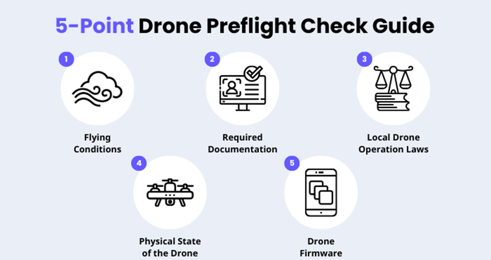
Before each drone flight, the operator - known as the Remote Pilot in Command (RPIC) - should go through a detailed checklist to ensure safety and effectiveness of the operation. It may seem like a lot to do, but it's critical for the safety and success of every drone mission.
Before every flight, make sure to check:
- Conditions: Check weather conditions to confirm it's safe to fly. High winds, pressure systems, and other weather conditions will adversely affect your operations and could be dangerous.
- Laws & Restrictions: Always check national airspace, temporary flight restrictions (TFRs), and local laws for the site at which you're planning to fly the drone. It is your responsibility to follow all applicable laws and regulations to keep airspace safe.
- Documentation: Confirm that you have your FAA license, drone registration, and any other documentation handy before you start flying. You will be required to present this documentation to any law enforcement officer upon request. Additionally, you are required to clearly mark your drone with the Drone Zone registration number so the drone can be identified in case of an accident or malfunction.
- Equipment: Make sure you have your drone, your control unit and batteries are fully charged, and that you've updated the firmware on your drone before starting the mission. Making sure you have the right equipment and that the equipment is in good condition is critical to safe and effective drone operations.
Here's a helpful visual guide you can reference before each flight.
Source: safetyculture.com
Depending on the purpose of your flight, you may also want to use software to pre-plan the mission. Most survey grade drones have the ability to schedule a flight prior to arriving at the jobsite. This mapping is recommended as it will allow the drone to automatically fly the set waypoints to provide the most accurate information of the jobsite. This allows for repeatable missions, where you can fly the exact same route many times to track progress over time.
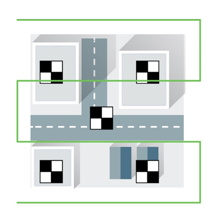
Additionally, using GCPs can maximize the accuracy of the drone flight. For the best practice of setting up the GCPs with an RTK-enabled drone, there will be minimum three GCPs needed. Using five GCPs would provide the best results. Always have these GCPs set under the drone’s flight path and do not set them in a straight line. If three GCPs are being used, at least set them up in a triangle to help the drone account for tilt, rotation, and scale. For the best result of GCP setup on a jobsite with five GCPs, place one GCP on each corner of the flight map and one in the middle as shown in the picture below from Pix4D.
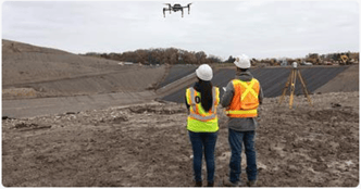
Additionally, when flying a drone, it is recommended to have another person monitor the drone and airspace. This person is known as a Visual Observer (VO). In case of a drone malfunction or unexpected air traffic in the area, the VO can tell the RPIC and keep the drone operation safe and compliant.
Once all the items in the checklist are prepared, you're ready to fly. Set up the GCPs on the jobsites, make sure the micro-SD card has been inserted if the drone requires a memory card, then watch the drone fly itself over the planned waypoint.
Once all the drone surveying is completed, pack up everything and extract the drone flight data from the SD card and download the data from the GCP. This information will be uploaded to the software to generate a digital twin of the jobsite.
Read more about digital twins on our blog here.
Regulations
As there are federal laws and state laws governing drone flight, drone laws differ from location to location. It is wise to make sure you review local regulations prior to flying the drone, even if you're confident that the flight you're planning complies with federal laws. Since drones are a fairly new technology, new laws and regulations are being updated every year. It is important to keep up with the limitations of flying the drones to avoid getting in trouble. The federal laws can be found in the FAA’s part 107 study guide, and state rules and regulations are well noted in the Master List of Drone Laws published by uavecoach.com.
When starting a new project, notify the project owner that there will be drone surveying completed at the project site. It might even be necessary to receive a written permit from the project owner to avoid conflicts.
How Smart Construction Can Help
Smart Construction Dashboard is a solution that utilizes drone survey data to efficiently plan jobsites without having to be on the jobsite. Smart Construction Dashboard creates a digital twin of the jobsite by utilizing the satellite view of the jobsite overlayed with 3D designs and drone survey data to provide accurate jobsite information. The built-in measuring tools allows measuring distance, volume, and even slopes with just click of a button. Plan your earthwork with ease by designing haul routes and designating stockpile locations.
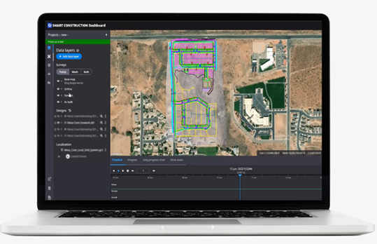
Smart Construction Dashboard improves on the conventional method of surveying by reducing survey time and giving contractors ability to keep track of earthwork by simply flying a drone periodically. Looking for a good surveyor might be a challenge; however, training someone to flying a drone and using Smart Construction Dashboard is significantly easier.
Smart Construction Simulation is a more advanced way to leverage drones for construction. Smart Construction will collect the drone data and the 3D-design data to consult with the client to simulate the work process to meet the project requirement. The client will be able to design a plan on the digital twin to calculate multiple scenarios with different work sequence, fleet, equipment bucket size, and budget. This is a great resource to maximize the efficiency of the resources and to set realistic goals that can be shared both internally and externally.
Reach out to learn more about Smart Construction Dashboard and Smart Construction Simulation and how Smart Construction can help you build your drone program to get more efficient and productive.
Additional References
- Drone Technology Overview
- Drone Types
- Drones in Construction
- Five Steps for Quality Drone Mapping
- Ground Control Best Practices from Aerotas and Pix4D